|
Me Sahyadri |
|
August 2019 |
|
Volume 6, number 8, # 85 |
|
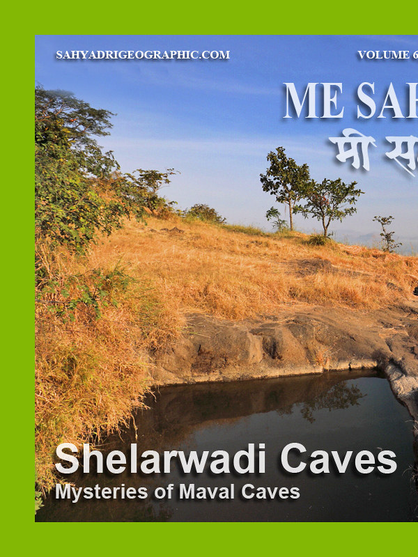
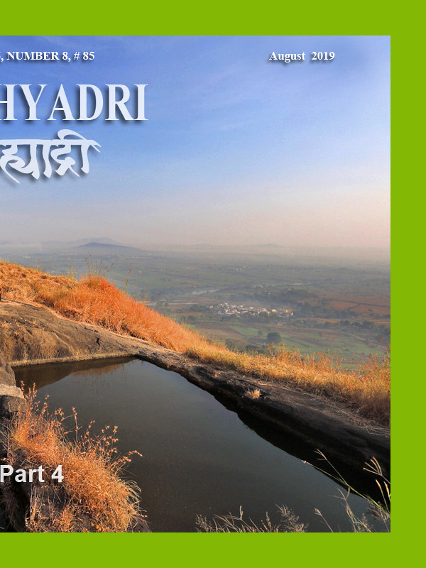
Mysteries of Shelarwadi Caves – Part 4 |
Please use minimum 1280 pixel horizontal screen resolution for viewing. Please be patient while all the images in webpage are loaded. Please do not use the images for any commercial use without permission. Text in Marathi and English is not exact translation. Please give sufficient time to allow the photographs to load. Special thanks to all those who helped me during the compilation and for the help and guidance during the activity. |
|
|
|
|
देशाची आर्थिक प्रगती व्हावी असे सर्व नागरिकांना वाटणे सहाजिक आहे. अर्थकारणामुळे मिळणारा रोजगार, समृद्धी यासाठी सर्वांनाच आर्थिक प्रगती हवी हवीशी वाटते. आर्थिक प्रगती होताना, त्याचा दिर्घकाळात समाजावर, निसर्गावर, वातावरणावर दुष्परिणाम होणार नाही याची काळजी घेणे महत्वाचे आहे. मनुष्याच्या भावी पिढ्यांना पाणी, शुद्ध हवा, योग्य वातावरण मिळत रहावे अशी भावना मनात रुजणे महत्वाचे आहे. वाढत्या आर्थिक प्रगतीमुळे नैसर्गिक संपदेवर ताण येतो. प्रगतीसाठी प्रदुषण होते. जंगले, माळराने, व इतर अधिवास नष्ट होतात. वसुंधरेवर रहाणाऱ्या इतर जीवांचा मात्र मनुष्य फारसा विचार करत नाही. आर्थिक प्रगती करताना, मनुष्य निसर्गाची हानी करत आहे. मुळताच माणसाला निसर्गाचे महत्व समजणे हे सध्याच्या आपल्या प्रगत जीवनशैली मुळे अवघड झाले आहे. आर्थिक प्रगती, समाजाची प्रगती व निसर्ग संपदेची निगा, यांचा समतोल राखणे काळाची गरज आहे.
सह्याद्री (पश्चिम घाट) हा एक नैसर्गिक संपदेचा, वैविध्यतेचा, भौगोलिक व ऐतिहासिक ठेवा आहे. वाढत्या मानवी अतिक्रमणाचा, सह्याद्रीच्या विविध घटकांवर होणारा दुष्परिणाम भविष्यात आपल्यालाच धोका निर्माण करेल, यात शंका नाही. शुद्ध पाणी, हवा व उर्जा, भावी पिढीला मिळण्यासाठी, नंद्यांचे उगम असलेला सह्याद्री व त्याभागातील जंगले टिकवणे महत्वाचे आहे. सह्याद्रीच्या महत्वाच्या घटकांचे महत्व छायाचित्रांद्वारे प्रकट करण्याचा मी येथे प्रयत्न केला आहे. येथील पक्षी, प्राणी, वनस्पती, अधिवास, किल्ले व लेणी अशा विविध विषयांबद्दल आपण समजुन घेऊ.
|
|
As the economic development has taken the center stage, the balance between the environmental sustenance and socio economic development will be under the scanner. As most experts with balanced views have proclaimed, Indian wildlife and ecological system sustenance will be under threat, unless precautions are taken with the help of appropriate research and long term national interests. As we encounter the economic development, many habitats which indirectly or directly help sustainable development will be damaged. The awareness to gauge the success by sustainable development and not by year to year growth is a distant dream any environmentalist will assume in current scenario.
Western ghats, or Sahyadri as we all call it as, is a treasure trove of spectacular landscapes, biodiversity, flora, fauna, some amazing geological wonders and man made monuments. With the increasing pressure from human encroachment, all these elements are under stress and in turn are under depletion. Western ghats should be left untouched by human beings, to protect their future generations from getting short of resources, such as water, energy and clean air. The important elements of western ghats, which need protection are highlighted in the new version of Photo journal, Me Sahyadri Magazine.
|
|
|
| |
|
| |
| Me Sahyadri – August 2019
|
| |
|
|
मावळ लेणी मोहेमेचा सारांश :
मावळातील भाजे, बेडसे आणि कार्ले लेणी अप्रतिम आहेत. त्यामुळे या भागातील इतर लहान लेण्यांकडे फारसे कोणी फिरकत नाही. आम्ही चार समविचारी मित्रांनी मात्र या हरवलेल्या लेण्यांची शोधाशोध करण्याचे ठरवले. साईप्रकाश बेलसरे, निनाद बारटक्के, अमेय जोशी आणि विवेक काळे असा संघ तयार झाला. एकोणीसाव्या शतकात जेम्स बर्जेस आणि जेम्स फर्ग्युसन या दोन इंग्रज विद्वानांनी भारतातील लेणी धुंडाळली. त्यांनी १८८० साली "केव्ह टेम्पल्स ऑफ इंडिया" या पुस्तकाचे प्रकाशन केले. या पुस्तकात मावळातील लहान लेण्यांचा फारसा तपशिल नसला तरी, या मावळातील इतर लहान लेण्यांबद्दल ५-६ वाक्यांमध्ये आम्हाला त्रोटक का होईना माहिती मिळाली. त्यांनी उल्लेख केलेली, काही ठिकाण सापडली, तर काही ठिकाण काहीही केल्या सापडेनात. कदाचित न सापडलेली ठिकाण नष्ट झाली असावीत. पण मोहिमे दरम्यान नविन, ज्या ठिकाणांचा पुस्तकात उल्लेख नव्हता, पण ग्रामीण भागातल्या स्थानिकांना माहिती होती अशी ठिकाण सापडली.
जेम्स बर्जेस आणि जेम्स फर्ग्युसन या दोन इंग्रज विद्वानांनी लिहिलेल्या प्रत्येक शब्दाचा धागा म्हणुन वापर करायचे ठरले. कामांचे वाटप झाले.
शोध मोहिमेत लागणाऱ्या खाऊची सोय करणे, विषय आणि ठिकाणाचा आधी अभ्यास करणे, प्रवासाची सोय करणे, गावकऱ्यांकडे लेण्यांबद्दल चौकश्या करणे, मोहिमे दरम्यान गचपणातुन वाट शोधणे, लेण्याच्या अवशेषांची मोजमाप घेऊन त्याची चित्रे/नकाशे काढणे, छायाचित्रे काढणे, जि. पि. एस. यंत्रावर वाटेबद्दल माहिती नोंदवणे, लेण्यात लहान बारकावे शोधणे, लेण्यांचे विश्लेषण करणे, नोंदी करणे, अशी वेगवेगळ्या प्रकारची काम वाटुन घेण्यात आली. प्रत्येक ठिकाणी जाताना, घरचा अभ्यास करावा लागला. जुनी पुस्तके, नकाशे धुंडाळले गेले. गावातल्या मित्रांची मदत झाली. गावागावात चौकश्या केल्या. गडद, लेणे, गुहा, कपार, भोगदा, विहार, पांडवांनी एका रात्री बनवलेली गुहा असे अनेक शब्द वापरुन चौकश्या झाल्या. बहुतेक वेळा असे काही नाही इथे ! तुम्ही कुठुन आलात ? असे उत्तर मिळाले. लेणे आहे का इथे कुठे असा प्रश्न विचारला तर आम्हाला बहुतेकांनी कार्ले/बेडसे/भाजे लेण्यांचा पत्ता दिला. पण बकऱ्या, गाई घेऊन डोंगरात फिरणारे गुराखी मात्र दरवेळेला मदतीला धाउन आले. वाटांचे आणि दिशांचे अंदाज मिळाले. जुजबी माहिती घेऊन ठिकाण शोधणे या प्रकाराचा चांगला सराव झाला. कधी काटेरी करवंदींच्या खालुन खुप सरपटाव लागल तर कधी घसाऱ्यावर हात टेकावे लागले.
लेण्यांमध्ये मोठे कोळी (स्पायडर), कातळ पाली, वटवाघळ, मधमाश्या, पाकोळ्या, घुबडं भेटले. आमच्या मुळे त्यांना उगाच त्रास झाला, असा अपराधीपणा वाटला. प्रत्येक शोधमोहिमेला यश आलेच असे नाही. काही ठिकाण सापडली नाहीत. तर काही ठिकाण आमच्याच मनाचे खेळ आहेत असे लक्षात आले. बहुतांश ठिकाणी कोणत्या ना कोणत्या प्रकारची जोखिम होती. वटवाघळ, लेण्यातील धुळ, काळोख, मधमाश्या, काटेरी वनस्पती, घसारा, गुहेतील ऑक्सिजन चा अभावआणि इतर न दिसणारे धोके यावर मात झाली. मोहिमेसाठी, विजेऱ्या, जि. पि. एस., मोजपट्या, दोऱ्या, लेजर यंत्र, नकाशे, गुगल मॅप, जाळीच्या टोप्या या सर्व जंत्रीचा उपयोग झाला. एकूण मिळुन २० नविन अपरिचित ठिकाण/वास्तु पहायला मिळाल्या, मावळाचा भुगोल जरा अजुन नीट लक्षात आला. नविन प्रश्न पडले आणि नविन कोडी सोडवयाला मिळाली. तर्क वितर्क झाले.
|
|
About the Maval Cave exploration :
The main caves in Maval region are so significant that other small hermit caves are often overlooked. We as a team of four like minded friends, decided to explore the Maval region for these small hermit caves. We explored and found few beautiful places. The very concept of creating a hermit cave somewhere high up in the hills is fascinating. These places often are full of tranquility and nothing else. With very little architectural evidences and clues, the academicians have obviously ignored these places. It was James Fergusson and James Burgess, during their exhaustive study of “Cave temples of India, 1880” mentioned few of these hermits in Maval region of Pune district. With the little clues and exhaustive investigation, team of four members, Saprakash Belsare, Amey Joshi, Ninad Bartakke and Vivek Kale started the exploration. The journey to locate, trek and analyse these hermit caves itself was fascinating. We met many villagers who were unaware of these places, but also met few shephards who were precisely aware of the hermits and gave us tentaive guidance.
There is a very brief mention about the misceleneous caves of Maval by James Fergusson and James Burgess in their work. Based on available information we decided to search these caves and monuments. The activities were planned. The food, travel , track exploration in difficult and routes full of foliage, enquiring the villagers about the caves, taking measurements and drawing skecthes and maps, photography, GPS data collection, making notes and analysing the information, observing the minor details of the caves etc activites were distributed amongst the team members. We met many bats, owls, geckos, lizards, large spiders, martins, honeybees during the treks. Often we felt sad that we disturbed them to see the caves. Most of these places are hazardous due to pitch darkness, bats, dust, thorny plants, honeybees, low oxygen level in caves and rock patches etc. Not all the attemps were successful. Sometimes we could not find the intended places and sometimes we realised that the cave was just our imagination and did not exist. Nevertheless we saw about 20 new strange caves/monuments during the exploration. The high intensity torches, GPS tool, measuring tapes and measuring laser tool, Honeybee protection caps, maps, google maps, photographs etc were useful during the mission. On this photoessay, I have compiled the exhaustive information and photographs of Shelarwadi Caves in Maval.
|
|
|
| |
  |
| The banner has been published here to improve the awareness of the trekkers and tourists visiting the various mountain forts, mountains in north western ghats. Please avoid accidents, by following good outdoor ethics such as no swimming in cisterns at mountain forts, no rock climbing without proper technical equipment and expertise. Please do not adventure, trek with any group or individually without understanding the risks associated. The frequency of the solo trekker fatalities have increased recently. Please strictly avoid solo treks. Please also avoid treks to mountains in large commercial groups, as it leads to damage to biodiversity of these high elevation ecological islands. Please respect the wildlife and biodiversity of the region. This has become more important as the ever increasing human interference is leading to severe damage to fragile ecosystems. Please be aware of the wildlife and biodiversity of the mountains before visiting these mountains. Please follow outdoor ethics. Follow ASI and Forest department rules. The concept of use of symbols for outdoor ethics was conceived and designed by "Sahyadri Trekker Bloggers Group". |
| |
|
|
| |
  |
| |
| 1. Maval Caves map, Maharashtra, India |
| |
|
|
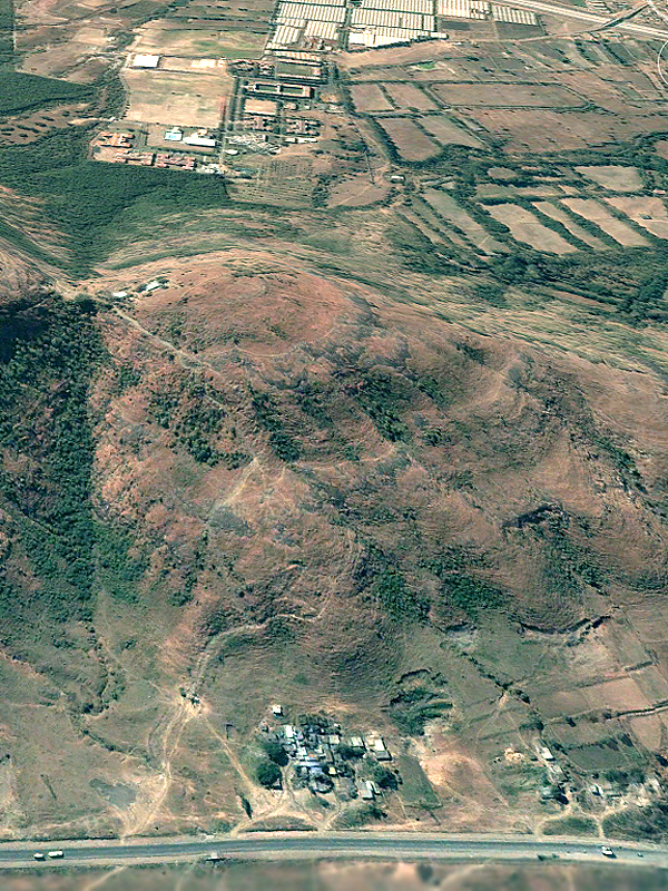
शेलारवाडी लेणी समूह घोरावडेश्वर डोंगरावर आहे. पुणे जिल्ह्यातील मावळ तालुक्यात, घोरावडेश्वर डोंगर पुणे शहरापासून अंदाजे ३० किलोमीटर अंतरावर आहे. शेलारवाडी लेणीसमुहातील लेणी, विहार आणि पाण्याच्या टाक्या पहाता, शेलारवाडी लेणीसमुह मावळातील एक मोठा लेणीसमुस आहे असे लक्षात येते. दक्खन च्या पठारावर सह्याद्रीच्या एका डोंगररांगेत शेलारवाडी लेणी समूह आहे. विसापुर डोंगररांग पश्चिम घाटातील कुरवंडे गावापासुन पूर्वेला घोरावडेश्वर (शेलारवाडी) डोंगरापर्यंत ३५ किमी पसरलेली आहे. विसापुर डोंगररांगेत, भाजे लेणी, बेडसे लेणी, लोहगड किल्ला, विसापुर किल्ला ही महत्वाची ऐतिहासिक वारसा स्थळ आहेत. कार्ले आणि विसापुर डोंगररांगांच्या मध्ये असलेल्या पठारी प्रदेशातुन इंद्रायणी नदी वाहते. इंद्रायणी पश्चिमेकडुन पूर्वेकडे वाहते. प्राचीन व्यापारी मार्ग या भागातुन इंद्रायणी खोऱ्यातुन जातो. हा प्राचीन व्यापारी मार्ग कोकणातल्या कल्य़ाण, सोपारा या बंदरांपासुन दक्खन च्या पठारावरच्या पैठण, तेर या गावांना जोडत होता. आज याच भागातुन मध्य रेल्वे आणि मुंबई-पुणे राष्ट्रीय मार्ग जातात. विसापुर डोंगररांगेच्या दक्षिणेला पवना नदीचे खोरे आहे. या खोऱ्यात बेडसे, तिकोना , येळघोळ , खडकवाडी येथे लेणी आहेत. इंद्रायणी आणि पवना खोऱ्याच्या मध्ये घोरावडेश्वर डोंगर आहे. घोरावडेश्वर डोंगराच्या आजूबाजूचा प्रदेश सुपीक आहे. शेलारवाडी लेणी समूहात असलेल्या विविध लेण्यांची संरचना, येथे असलेले शिलालेख आणि इतर पुराव्यांवरून हा लेणीसमूह इसवीसनानंतर अंदाजे ३ऱ्या शतकात कोरला असावा असा अंदाज अभ्यासकांनी नोंदवला आहे.
|
|
Shelarwadi cave complex is located on Ghoravadeshwar hill. Ghorawadeshwar hill is located in Maval tehsil in Pune district in Maharashtra state in India, at about 30 km north west of Pune city center. The hill is part of the extension of the Sahyadri hill range on the Deccan plateau. Spread in west–east orientation, this hill range, which is about 35 kilometer in length, spread from the Kurwande village at western ghat ridge, south of Lonavala up to the Ghoravadeshwar hills towards east. Visapur fort, Lohgad forts, Bhaje Caves and Bedse caves are located in this hill range. This hill range is referred as Visapur range. Between Karle range and Visapur range, Indrayani river flows from west to east, and the plateau is called as Indrayani basin. Indrayani river originates in the hills around Lonavala. The ancient trade route climbs up the western ghat ridge from the Konkan over to the Deccan plateau at Lonavala. Once atop Deccan plateau at Lonavala, the trade route is aligned parallel to Indrayani river. This ancient trade route was used to transport the goods from the eastern economic centers on the Deccan plateau to Kalyan and Sopara ports on the west coast of India. Today the modern Mumbai-Pune road and Central railway line passes through the same Indrayani river basin, which was used for ancient trade in the past. South of Visapur range there is a Pawana river basin, which is also the fertile region with caves located at places such as Bedse, Yelghol and Khadakwadi, Tikona. Ghoravadeshwar hill is located between Indrayani river basin and Pawana river basin. Both the trade routes coming via Pawana basin and Indrayani basin meet near Shelarwadi caves. The hill is surrounded by fertile land. Based on archeological, paleographical and other evidences the cave complex at Shelarwadi is estimated to have been carved in 3rd century CE. Based on the number of exacavations it is one of the largest cave complex in Maval region.
|
|
|
| |
  |
| |
| 3. Aerial Map, Shelarwadi Caves, Pune district, Maharashtra, India |
| |
|
|
घोरावडेश्वर डोंगराला गारोडी, गुरोडी अशी नाव पूर्वी वापरली असल्याचे आढळते. धामणे, साळुम्ब्रे, सांगवडे, गहुंजे, शिरगाव, सोमाटणे, गोदुम्ब्रे, दारुम्ब्रे, चिखले, घोरावडी या गावांच्या जवळ घोरावडेश्वर डोंगर आहे. या विविध गावांतुन डोंगरावर येण्यासाठी ९ पायवाटा आहेत. यातील सहा पायवाटांवर पाण्याची पुरातन टाकी आहेत. या डोंगरावर इसवीसनानंतर तिसऱ्या शतकात कोरलेल्या बुद्ध लेणी आहेत. या लेणीसमूहात एकूण १९ पाण्याची टाकी आणि १२ लेणी आहेत. डोंगराच्या विविध भागात विखुरलेल्या या लेणी समूहात साध्या लेणी आहेत. यात फारसे नक्षीकाम आढळत नाही. नंतरच्या काळात अंदाजे पंधराव्या शतकात येथे दोन विहारात शंकराच्या पिंडीची स्थापना झाली. एका विहारात विठ्ठल रखुमाईचे देऊळ आहे. या लेणीसमूहात तीन पाली (प्राकृत) भाषेतले ब्राह्मी लिपीतले शिलालेख आहेत. इतर तीन शिलालेख मराठी भाषेत देवनागरी लिपीत कोरले आहेत. शेलारवाडी च्या काही लेण्यात पोहोचणे अत्यंत अवघड आहे. काही लेणी कड़्यात आहेत. येथे जाण्यासाठी गिर्यारोहणाचा योग्य अनुभव आणि यंत्रणा आवश्यक आहे. या ठिकाणी दरी खुप खोल असुन अपघात होऊ शकतो. शेलारवाडी च्या या लेणी समुहात विविध गट आहेत. नैऋत्य (दक्षिण पश्चिम) बाजुस वरच्या टप्यात दोन पाण्याची टाकी (क्रमांक १, ३) आणि दोन लेणी (क्रमांक २,३) आहेत. पावसाळ्यात नैऋत्य (दक्षिण पश्चिम) कडुन वारे वाहतात. यामुळे पावसामुळे होणारी धुप नेहेमी डोंगराच्या पश्चिम बाजुस जास्त होते. इथे हेच पहावयास मिळते. दक्षिण पश्चिमेला असलेल्या लेण्यांच्या दर्शनी भागाची पडझड झाली आहे. नैऋत्य (दक्षिण पश्चिम) बाजुस पण थोड़्या खालच्या टप्यात तीन पाण्याची टाकी (क्रमांक ५,७,९) आणि चार लेणी (क्रमांक ६,८,१०,१७) आहेत. शेलारवाडी च्या या लेणी समुहात उत्तर पश्चिमेकडे (वायव्य दिशेला) दर्शनी भाग असलेल्या चार लेणी (क्रमांक ११,१३,१४,१६) आणि दोन पाण्याच्या टाक्या (क्रमांक १२, १५) आहेत. येथे १२ ते १६ वास्तु, मात्र ११ क्रमांकाच्या लेण्याच्या वर कड़्यावर दुर्गम ठिकाणी आहेत. लेणीसमुहात विविध सहा वाटांवर पाण्याची टाकी आहेत. लेणीसमुहात एक गुहा वजा लेणे पुर्वेकडे आहे. तर एक ज्वालामुखी नळी वजा गुहा दक्षिण पुर्वेकडे (आग्नेय दिशेला) आहे. शेलारवाडीच्या लेण्यात कुठे ही बुद्धाची किंवा इतर मुर्ती दिसत नाही. येथे स्तुपाची पुजा केली जात होती. यावरुन या लेण्यात हिनयान (थेरवाद) पंथाचे अनुयायी रहात असावेत असे म्हणता येइल. हिनयान पंथाने कोरलेल्या लेण्यातली शेलारवाडी लेणे शेवटच्या काळातले (३ रे शतक उत्तरार्ध) असावे असे अभासकांचे मत आहे.
|
|
There are two adjascent hills at Shelarwadi. The hill on the west is relatively smaller in height and is less spread as compared to the main hill on the east side. Ghoravadeshwar hill was earlier known as Gurodi or Garodi hill.
The Ghoravadeshwar hill has fascinating cave complex, which is Buddhist Monastery excavated in around 3rd century A.D. Later in 15th century, two of the caves were converted to Shiva shrines. There are total 31 excavations on this hill at various locations, which includes 19 water cisterns and 12 caves, in total. There are total six inscriptions which include three Pali inscriptions in Brahmi script and three Marathi inscriptions in Devnagari script.
Various villages namely, Dhamane, Salumbre, Sangavade, Gahunje, Shirgaon, Somatane,Ghorawadi, Godumbre, Darumbre, and Chikhale surround the hill. The caves are also referred as Shelarwadi caves. There are 9 different pathways to climb the hill, from all the directions. Some of these pathways have the water cisterns made alongthe pathway, to cater the water to the pilgrims visiting the monastery. Out of these 9 pathways, 6 pathways have the water cisterns enroute.
Some of the caves are difficult to access. Without proper training and equipments, one should not attempt to visit these difficult caves, as there is a direct exposure to a fall of more than 100 feet while reaching some of these caves. There are various groups of caves in this complex. The excavations in south west scarp located at higher level consist of Cave number 2,3 and water cisterns number 1,4.
At slightly lower level on the same side there are excavations which consist of caves (number 6,8,10,17) and water cisterns (number 5,7,9). On the north west side there is a cave 11. In this north west group there are more excavations at higher level on the cliff. (Cave number 13,14,16 and water cisterns 12,15). These are very difficult to access as there is no railing here and there is exposure to fall of more than 100 feet. There are also many water cisterns on this hill which are spread out on various 6 trails. Theere is a cave on the east side. There is also a volcanic tube like natural cave on the south east direction. The hill in general has got more eroded on south west side as compared to east. Due to direction of monsson winds and rains, many caves located on the south west side are eroded. The front facades of most of these caves are damaged, in the process. Shelarwadi caves are Hinayana caves, as there are no sculptures of Buddha here, and Stupa was being worshipped. These is probabaly one of the last Hinayan caves made.
|
|
|
| |
  |
| |
| 4. Various excavations at Shelarwadi Caves complex, Pune district, Maharashtra, India |
| |
|
|
| |
  |
| |
| 5.Cave (excavation #17) South west face at Shelarwadi Caves complex, Pune district, Maharashtra, India |
| |
|
|
| |
  |
| |
| 6. Cave (excavation #17) South west face at Shelarwadi Caves complex, Pune district, Maharashtra, India |
| |
|
|
| |
  |
| |
| 7. Cave (excavation #17) South west face at Shelarwadi Caves complex, Pune district, Maharashtra, India |
| |
|
|
| |
  |
| |
| 8. Cave (excavation #17) South west face at Shelarwadi Caves complex, Pune district, Maharashtra, India |
| |
|
|
| |
  |
| |
| 9. Cave (excavation #17) South west face at Shelarwadi Caves complex, Pune district, Maharashtra, India |
| |
|
|
| |
  |
| |
| 10. Cave (excavation #17) South west face at Shelarwadi Caves complex, Pune district, Maharashtra, India
|
| |
|
|
| |
  |
| |
| 11. Cave (excavation #17) South west face at Shelarwadi Caves complex, Pune district, Maharashtra, India
|
| |
|
|
| |
  |
| |
| 12. Cave (excavation #17) South west face at Shelarwadi Caves complex, Pune district, Maharashtra, India |
| |
|
|
| |
  |
| |
| 13. Cave Layout (excavation #17) South west face at Shelarwadi Caves complex, Pune district, Maharashtra, India |
| |
|
|
वास्तू क्रमांक १७, एक लेणे आहे.
पूर्व डोंगराच्या दक्षिण पश्चिम बाजूस कड्यावर हे लेणे आहे. लेणे क्रमांक १० च्या ५ मीटर दक्षिणेला कड्याच्या खालच्या बाजूस असलेले हे लेणे दुर्गम आहे. येथे पोहोचणे अवघड आहे. तरबेज गिर्यारोहकानेच येथे जावे. उभ्या कातळावर चढाई केल्यावर येथे पोहोचता येते. या लेण्यात एक विहार आहेत . विहारात दोन बाक आहेत. लेण्यात माणसाचा फारसा वावर नाही. प्राण्यांचा वावर मात्र जाणवतो. बाक भग्न अवस्थेत आहेत. विटा वापरून बाकांची डागडुजी केलेली दिसते. समोरच्या बाजूला असलेल्या प्रवेशद्वाराला सुद्धा खालच्या बाजूला विटा दगडांचा वापर करून भिंत तयार केली आहे. दरवाजाचा फक्त वरचा भाग उघडा आहे. याचा आकार अर्धगोलाकार आहे. याचा आकार अंदाजे २.१५ मीटर रुंद , २.१५ मीटर लांब आणि २.१५ उंच आहे. विहाराची पातळी बाहेरच्या जमिनीच्या पातळीच्या खाली आहे. विहाराचे छत सपाट आहे. भिंती जीर्ण झाल्या आहेत. विहाराच्या आतल्या भिंतीवर खाचा केल्या आहेत. वस्तू वर अडकवण्यासाठी वासा लावण्यासाठी या खाचा केल्या असाव्यात. मागच्या भिंतीवर एक नैसर्गिक भोक आहे. दुर्गम आणि भयाण अशा या लेण्यात प्राण्यांची विष्ठा आणि हाड आढळतात. विहार अत्यंत लहान आहे.
|
|
The excavation#17 is the cave with one cell, located on the southwest scarp of the eastern hill below cave#10. The cave is located on the scarp and is difficult to access. Only the experienced mountaineer should visit this cave. The cell has a door, which is semi-circular at the top. There are two broken benches inside the cave, one on either side. Both the broken benches have been reinforced with brick work to make the benches usable. There are holes in the wall, indicating that poles were used to hang the objects. The cell is very small and has a small natural hole in the back wall. The ceiling is flat. The cave is not visited by many and is mainly is being visited by animals. The evidences of which can be seen inside the cave. The door opening of the cave is blocked in the lower part using bricks and stones, making the door opening very small. The cave is 2.15 meter (length) x 2.15 meter (breadth) x 2.15 meter (height), in size.Only the experienced mountaineer should visit this cave with all safety precautions.
|
|
|
| |
  |
| |
| 14. Water cistern (excavation #18), Shelarwadi Caves complex, Pune district, Maharashtra, India |
| |
|
|
वास्तू क्रमांक १८, एक भूमिगत पाण्याचे टाके आहे.
पश्चिम डोंगराच्या दक्षिण बाजूस कातळात हे पाण्याचे टाके आहे. येथे एकूण पाण्याची चार टाकी आहेत. टाके भूमिगत आहे. याचा आकार अंदाजे २.५ मीटर बाय २.५ मीटर आहे. टाक्याची खोली अंदाजे २.२ मीटर आहे. १३७५० लिटर पाणी यात मावते. एवढे पाणी १५ माणसांना नऊ महिने पिण्यासाठी पुरेल. टाक्याचे मुख चौकोनी आहे. मुखाचा आकार ०.९ मीटर बाय ०.९ मीटर आहे.
|
|
The excavation#18 is the small underground water cistern, located on the located on the top of the western hill on south side. This is one of the four cisterns carved adjacent to each other. There is a small square opening atop the cistern roughly about 0.9 meter by 0.9 meter. The cistern is about 2.5 meter wide, 2.5 meter in breadth and 2.2 meter deep. The water cistern can hold about 13750 litre water, just sufficient for 15 people for drinking purpose over 9 months.
|
|
|
| |
  |
| |
| 15. Water cistern (excavation #19), Shelarwadi Caves complex, Pune district, Maharashtra, India |
| |
|
|
वास्तू क्रमांक १९, एक उघडे पाण्याचे टाके आहे.
पश्चिम डोंगराच्या दक्षिण बाजूस कातळात हे पाण्याचे टाके आहे. येथे एकूण पाण्याची चार टाकी आहेत. टाके उघडे आहे. याचा आकार अंदाजे १.३५ मीटर बाय १.३५ मीटर आहे. टाक्याची खोली अंदाजे १.३५ मीटर आहे. २४६० लिटर पाणी यात मावते. एवढे पाणी २-३ माणसांना नऊ महिने पिण्यासाठी पुरेल.
|
|
The excavation#19 is the small open water cistern, located on the located on the top of the western hill on south side. This is one of the four cisterns carved adjacent to each other. The cistern is about 1.35 meter wide, 1.35 meter in breadth and 1.35 meter deep. The water cistern can hold about 2460 litre water, just sufficient for 2-3 people for drinking purpose over 9 months.
|
|
|
| |
  |
| |
| 16. Water cistern (excavation #20), Shelarwadi Caves complex, Pune district, Maharashtra, India |
| |
|
|
वास्तू क्रमांक २०, एक उघडे पाण्याचे टाके आहे.
पश्चिम डोंगराच्या दक्षिण बाजूस कातळात हे पाण्याचे टाके आहे. येथे एकूण पाण्याची चार टाकी आहेत. टाके उघडे आहे. याचा आकार अंदाजे ३.२ मीटर बाय २.४ मीटर आहे. टाक्याची खोली अंदाजे १.६ मीटर आहे. १२२८८ लिटर पाणी यात मावते. एवढे पाणी १४ माणसांना नऊ महिने पिण्यासाठी पुरेल.
|
|
The excavation#20 is the relatively large open water cistern, located on the located on the top of the western hill on south side. This is one of the four cisterns carved adjacent to each other. The cistern is about 3.2 meter wide, 2.4 meter in breadth and 1.6 meter deep. The water cistern can hold about 12288 litre water, just sufficient for 14 people for drinking purpose over 9 months.
|
|
|
| |
  |
| |
| 17. Water cistern (excavation #21), Shelarwadi Caves complex, Pune district, Maharashtra, India |
| |
|
|
वास्तू क्रमांक २१, एक उघडे पाण्याचे टाके आहे.
पश्चिम डोंगराच्या दक्षिण बाजूस कातळात हे पाण्याचे टाके आहे. येथे एकूण पाण्याची चार टाकी आहेत. टाके उघडे आहे. याचा आकार अंदाजे २.७ मीटर बाय २.७ मीटर आहे. टाक्याची खोली अंदाजे २.५ मीटर आहे. १८२२५ लिटर पाणी यात मावते. एवढे पाणी २० माणसांना नऊ महिने पिण्यासाठी पुरेल.
या चार पाण्याच्या टाक्यांमध्ये एकूण मिळून ४६७०० लिटर पाणी मावते. एवढे पाणी ५२ माणसांना नऊ महिने पिण्यासाठी पुरेल.
|
|
The excavation#21 is the relatively large open water cistern, located on the located on the top of the western hill on south side. This is one of the four cisterns carved adjacent to each other. The cistern is about 2.7 meter wide, 2.7 meter in breadth and 2.5 meter deep. The water cistern can hold about 18225 litre water, just sufficient for 20 people for drinking purpose over 9 months.
These four water cisterns all put together can hold about 46700 liter water, sufficient for 52 people for drinking purpose over 9 months.
|
|
|
| |
  |
| |
| 18. Layout of Water cisterns (excavation #18,19,20,21), Shelarwadi Caves complex, Pune district, Maharashtra, India |
| |
|
|
| |
  |
| |
| 18a. Sky view of Layout of Water cisterns (excavation #18,19,20,21), Shelarwadi Caves complex, Pune district, Maharashtra, India |
| |
|
|
| |
  |
| |
| 19. Water cistern (excavation #22), Shelarwadi Caves complex, Pune district, Maharashtra, India |
| |
|
|
वास्तू क्रमांक २२, एक उघडे पाण्याचे टाके आहे.
पश्चिम डोंगराच्या उत्तर बाजूस माथ्यावर कातळात हे पाण्याचे टाके आहे. टाके उघडे आहे. याचा आकार अंदाजे १.५ मीटर बाय २.५ मीटर आहे. टाक्याची खोली किती आहे हे त्यात साठलेल्या गाळामुळे सांगता येत नाही. हे टाके सोमाटणे गावापासून लेण्यांकडे येणाऱ्या वाटेवर आहे. याची खोली जर १.५ मीटर गृहीत धरली तर यात अंदाजे ५५०० लिटर पाणी मावते असे म्हणता येईल.
|
|
The excavation#22 is relatively small open water cistern, located on the west side of the eastern hill, The cistern#22 is about 1.5 meter wide, 2.5 meter in breadth. The depth is not known as the cistern is filled with rubble. This water cistern is located on the path from Somatane village towards the cave temple. If it is assumed that the cistern is about 1.5 meter deep, the cistern holds about 5500 liter of water.
|
|
|
| |
  |
| |
| 21. Water cistern (excavation #23), Shelarwadi Caves complex, Pune district, Maharashtra, India |
| |
|
|
| |
  |
| |
| 22. Water cistern (excavation #23), Shelarwadi Caves complex, Pune district, Maharashtra, India |
| |
|
|
| |
  |
| |
| 23. Water cistern (excavation #23), Shelarwadi Caves complex, Pune district, Maharashtra, India |
| |
|
|
| |
  |
| |
| 24. Layout of Water cistern (excavation #23), Shelarwadi Caves complex, Pune district, Maharashtra, India |
| |
|
|
वास्तू क्रमांक २३, एक उघडे पाण्याचे टाके आहे.
पूर्व डोंगराच्या दक्षिण पश्चिम बाजूस असलेल्या गावांपासून डोंगरावर येण्यासाठी एक पायवाट आहे. या पायवाटेवर अंदाजे डोंगरमाठयाच्या १३० मीटर खाली जंगलात एक पाण्याचे टाके आहे. वाटसरूंसाठी तयार केलेले हे टाके कदाचित गावात भिक्षा मागून डोंगराकडे परतणाऱ्या भिक्षुकांसाठी बनवलेले असावे.
कातळात हे पाण्याचे टाके आहे. टाके उघडे आहे. याचा आकार अंदाजे २.१ मीटर बाय १.४ मीटर आहे. टाक्याची खोली अंदाजे १.४ मीटर आहे. ४११६ लिटर पाणी यात मावते. एवढे पाणी ३० भिक्षुकांना, रोज अर्धा लिटर पाणी वापरले तर नऊ महिने पिण्यासाठी पुरेल.
|
|
The excavation#23 is the small open water cistern, located on the pathway below eastern hill at about 689 meter altitude above msl, i.e. about 130 meter below the hill top. This cistern seems to have been made for the visitors who are climbing the hill from south west side. The cistern is about 1.4 meter wide, 2.1 meter in breadth and 1.4 meter deep. The water cistern can hold about 4116 litre water, just sufficient for 30 people per day, if they were drinking about 500 ml water at one instance.
|
|
|
| |
  |
| |
| 25. Water cisterns (excavation #24,25), Shelarwadi Caves complex, Pune district, Maharashtra, India |
| |
|
|
| |
  |
| |
| 26. Water cisterns (excavation #24,25), Shelarwadi Caves complex, Pune district, Maharashtra, India |
| |
|
|
| |
  |
| |
| 27. Water cisterns (excavation #24,25), Shelarwadi Caves complex, Pune district, Maharashtra, India |
| |
|
|
| |
  |
| |
| 28. Water cisterns (excavation #24,25), Shelarwadi Caves complex, Pune district, Maharashtra, India |
| |
|
|
| |
  |
| |
| 29. Game markings at Water cisterns (excavation #24,25), Shelarwadi Caves complex, Pune district, Maharashtra, India |
| |
|
|
| |
  |
| |
| 30. Layout of Water cisterns (excavation #24,25), Shelarwadi Caves complex, Pune district, Maharashtra, India |
| |
|
|
वास्तू क्रमांक २४ आणि २५, दोन लगत असलेली उघडी पाण्याची टाकी आहेत.
पूर्व डोंगराच्या पूर्व बाजूस असलेल्या गावांपासून डोंगरावर येण्यासाठी एक पायवाट आहे. या पायवाटेवर अंदाजे डोंगरमाठयाच्या २० मीटर खाली कातळात दोन पाण्याची उघडी टाकी आहेत.
टाके क्रमांक २४ याचा आकार अंदाजे ५.२५ मीटर बाय ३.५ मीटर आहे. टाक्याची खोली अंदाजे २.२ मीटर आहे. ४०४२५ लिटर पाणी यात मावते. एवढे पाणी ४५ भिक्षुकांना, नऊ महिने पिण्यासाठी पुरेल.
टाके क्रमांक २५ याचा आकार अंदाजे ६.३ मीटर बाय ४ मीटर आहे. टाक्याची खोली अंदाजे १.८ मीटर आहे. ४५२०० लिटर पाणी यात मावते. एवढे पाणी ५० भिक्षुकांना, नऊ महिने पिण्यासाठी पुरेल.
टाके क्रमांक २४ आणि २५ यात एकूण ८५६०० लिटर पाणी मावते. एवढे पाणी ९५ भिक्षुकांना, नऊ महिने पिण्यासाठी पुरेल.
|
|
The excavation#24 and #25 are relatively large open water cisterns, located on the top of the eastern hill, towards east side about 20 meter below the top of the hill. These two water cisterns are carved adjacent to each other. The cistern#24 is about 5.25 meter wide, 3.5 meter in breadth and 2.2 meter deep. The water cistern can hold about 40425 litre water, just sufficient for 45 people for drinking purpose over 9 months. The cistern#25 is about 6.28 meter wide, 4 meter in breadth and 1.8 meter deep. The water cistern can hold about 45200 litre water, sufficient for 50 people for drinking purpose over 9 months. Both water cisterns put together can hold about 85600 litre water, sufficient for 95 people for drinking purpose over 9 months.
|
|
|
| |
  |
| |
| 31. Water cistern (excavation #29), Shelarwadi Caves complex, Pune district, Maharashtra, India |
| |
|
|
वास्तू क्रमांक २९, एक उघडे पाण्याचे टाके आहे.
पूर्व डोंगराच्या पश्चिम बाजूस माथ्यावर कातळात हे पाण्याचे टाके आहे. टाके उघडे आहे. याचा आकार अंदाजे ५ मीटर बाय ५ मीटर आहे. टाक्याची खोली अंदाजे १.६ मीटर आहे. ४०००० लिटर पाणी यात मावते. एवढे पाणी ४४ माणसांना नऊ महिने पिण्यासाठी पुरेल.
|
|
The excavation#29 is relatively small open water cistern, located on the top of the eastern hill, The cistern#29 is about 5 meter wide, 5 meter in breadth and 1.6 meter deep. The water cistern can hold about 40000-litre water, just sufficient for 44 people for drinking purpose over 9 months.
|
|
|
| |
  |
| |
| 32. Water cistern (excavation #26), Shelarwadi Caves complex, Pune district, Maharashtra, India |
| |
|
|
वास्तू क्रमांक २६, एक भूमिगत पाण्याचे टाके आहे.
पूर्व डोंगराच्या पश्चिम बाजूस माथ्यापासून २० मीटर खाली कातळात हे पाण्याचे टाके आहे. टाके झाकलेले आणि भूमिगत आहे. याचा आकार अंदाजे ८.५ मीटर बाय ३ ते ४.८ मीटर आहे. टाक्याची खोली अंदाजे २.४ मीटर आहे. ८५००० लिटर पाणी यात मावते. एवढे पाणी ९४ माणसांना नऊ महिने पिण्यासाठी पुरेल.
|
|
. The excavation#26 is relatively large underground water cistern, located on the top of the eastern hill, towards west side about 20 meter below the top of the hill. The cistern#26 is about 8.5 meter wide, 3 to 4.8 meter in breadth and 2.4 meter deep. The water cistern can hold about 85000 litre water, just sufficient for 94 people for drinking purpose over 9 months.
|
|
|
| |
  |
| |
| 33. Water cistern (excavation #26), Shelarwadi Caves complex, Pune district, Maharashtra, India |
| |
|
|
| |
  |
| |
| 34. Water cistern (excavation #26), Shelarwadi Caves complex, Pune district, Maharashtra, India |
| |
|
|
| |
  |
| |
| 35. Water cistern (excavation #27), Shelarwadi Caves complex, Pune district, Maharashtra, India |
| |
|
|
| |
  |
| |
| 36. Water cistern (excavation #27), Shelarwadi Caves complex, Pune district, Maharashtra, India |
| |
|
|
वास्तू क्रमांक २७, एक भूमिगत पाण्याचे टाके आहे.
पूर्व डोंगराच्या उत्तर बाजूस माथ्यापासून २० मीटर खाली कातळात हे पाण्याचे टाके आहे. टाके झाकलेले आणि भूमिगत आहे. याचा आकार अंदाजे ३.५ मीटर बाय २ मीटर आहे. टाक्याची खोली अंदाजे २.४ मीटर आहे. १६८०० लिटर पाणी यात मावते. एवढे पाणी १८ माणसांना नऊ महिने पिण्यासाठी पुरेल. पायवाटेच्या बाजूला थोड्या खालच्या पातळीवर असलेल्या या टाक्याच्या सभोवती भिंत बांधलेली आहे. टाक्याचे मुख अंदाजे १. ९ मीटर बाय १.९ मीटर आहे.
|
|
The excavation#27 is relatively large underground water cistern, located on the top of the eastern hill, towards north side about 20 meter below the top of the hill. The cistern#27 is about 3.5 meter wide, 2 meter in breadth and 2.4 meter deep. The water cistern can hold about 16800 litre water, just sufficient for 18 people for drinking purpose over 9 months. The water tank has small opening of about 1.9 meter by 1.9 meter. The modern wall has been built around the cistern.
|
|
|
| |
  |
| |
| 37. Post holes, wall groves and markings (excavation #28), Shelarwadi Caves complex, Pune district, Maharashtra, India |
| |
|
|
| |
  |
| |
| 38. Post holes, wall groves and markings (excavation #28), Shelarwadi Caves complex, Pune district, Maharashtra, India |
| |
|
|
वास्तू क्रमांक २८, कातळावर असलेल्या एका बांधकामाच्या खुणा आहेत.
पूर्व डोंगराच्या पूर्व बाजूस बेगडेवाडी कडून माथ्यावर जाणाऱ्या वाटेवर कातळावर बांधकामाच्या खुणा आहेत. कातळावर अंदाजे १० मीटर लांब भिंत रचण्यासाठी असलेली खाच आहे. या खाचेत सहा ठिकाणी खांब रोवण्यासाठी खाचा केलेल्या आढळतात. येथे अनेक ठिकाणी गोलाकार खळगे आणि इतर आकृत्या कोरलेल्या आढळतात.
|
|
The excavation#28 is the set of sockets on the rock surface. This rock surface is located on the pathway from Begdewadi towards the hill top. There is a socket groove of about 130 mm width and it is about 10 meter in length. At the regular interval along this socket grove, there are six rectangular sockets to fix the pillars. There must have been a wall built here to support the structure. The use of the large rock surface may have been used for some purpose either a check post or for some other purpose. Large number (about 8) sets of of semispherical groves can be seen here along with the game boards scribed on the surface.
|
|
|
| |
  |
| |
| 39. Post holes, wall groves and markings (excavation #28), Shelarwadi Caves complex, Pune district, Maharashtra, India |
| |
|
|
| |
  |
| |
| 40. Post holes, wall groves and markings (excavation #28), Shelarwadi Caves complex, Pune district, Maharashtra, India |
| |
|
|
| |
  |
| |
| 41. Post holes, wall groves and markings (excavation #28), Shelarwadi Caves complex, Pune district, Maharashtra, India |
| |
|
|
| |
  |
| |
| 42. Post holes, wall groves and markings (excavation #28), Shelarwadi Caves complex, Pune district, Maharashtra, India |
| |
|
|
| |
  |
| |
| 43. Post holes, wall groves and markings (excavation #28), Shelarwadi Caves complex, Pune district, Maharashtra, India |
| |
|
|
| |
 |
| |
|
|
References :
1. Cave temples of India, London, 1880, Fergusson James and Burgess James.
2. Gazetters of Bombay Presidency, Pune District, Volume XVIII, 1885.
3. Buddhist architecture of western India, 1981, S. Nagraju.
4. Late Hinayan Caves of western India - M.K. Dhavalikar, 1984
5. Two Inscriptions from the Ghoravadesvara caves near Shelarwadi. – Amol Bankar, Annals of BORI, 2011
|
| |
|
|
| |
|